Category Archives: Historical Photographs

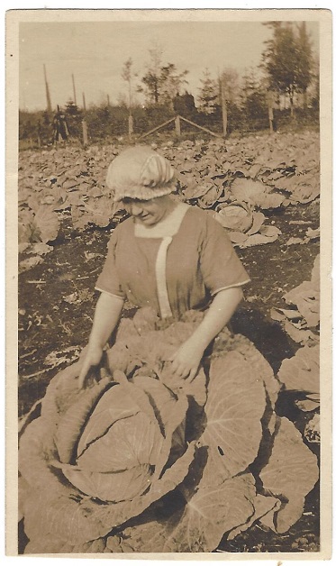
Field of Giant Cabbages !


Lots of Cole Slaw!

For those who are eating from their gardens right now, we thought we would share this snapshot from our collection.  The writing on the back says “Mrs. Lund friend of Grandma’s who lived in Stanwood Wash”  Her first name was thought to be Agnes.

Not sure how you would even cut it up!

If you know who this might be, let us know!


Once a town – East Stanwood, 1922-1960

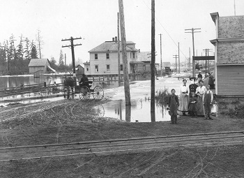
East Stanwood  Undated, circa 1900; shows early flooding and street view looking west from the depot and railroad tracks

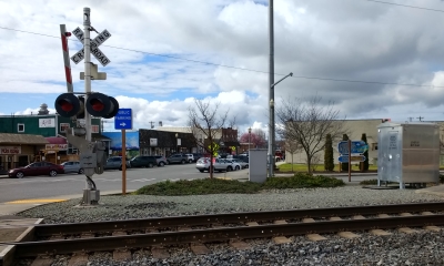
Stanwood was once two towns.  The original pre-1890s riverfront “town” grew during the 1870s and 1880s at the mouth of the Stillaguamish River.  Then when the railroad went through a mile east, a new commercial district formed around the depot referred to as “East Stanwood.”  The photos are then and now views of East Stanwood before the commercial buildings were built.

East Stanwood was platted in 1906 but not incorporated until 1922.  In the meantime the commercial area we now know grew as the railroad provided more direct transportation than the steamboats that served the original Stanwood near the Twin City Foods area.  In the top photo the H&H railroad tracks are visible on the left.

The two story building on the left still exists but was moved to 27122 88th Ave. N.W. It was known as the Peterson Apartments.

“East Stanwood” 2018 

The early buildings in the top photo seem much closer to the tracks than they appear in this contemporary view.

Visit the museum for more of the story.


Historic brick buildings alive and well

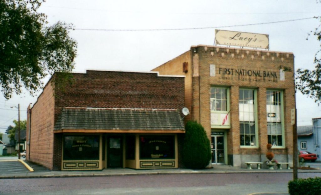
Brick buildings on the brick street, circa 2004; Both buildings are recognized in our Historic Plaque Program.

The photo above shows two of Stanwood’s historic buildings on Main Street.
Main Street is one of the few brick streets left in Snohomish County and the street itself is historic!
The “First National Bank” building on the right was built in 1930 when the original brick Bank of Stanwood outgrew its original location and merged with the Citizens State Bank across the street (see Echoes#60).  It was built by a contractor named Ed Peterson at the corner of Center and Union St.  replacing the Simonson shoe shop.  It was constructed of “concrete with light colored brick, terra cotta and marble facing” (TCN Sept 11, 1930). It had several owners since 1967 when it moved again and is now called the First National Professional Center.

The Antique store (brick building on the left) was long known as Hartney’s Style Shop.  The building was built by Jeremiah Hartney in 1925.  He came to Stanwood in 1906 as a tailor and had a shop on Market Street in his early business years.  Hartney died in 1945. Clyde Tolin managed the shop until his death in 1948 and according to the Stanwood Story (v.3 p. 31) it was sold to George Hammer and operated by Bill Bradford.  Women’s wear was brought to store in the 1960s Bradford sold it to Ken and Audrey Carlson in 1974. It went out of business in October of 1997 after Ken Carlson died.

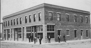
Circa 1904 view of Stanwood’s Historic Banking corner – Was Market Street and Broadway and is now 102nd Ave and S. R. 532.

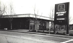
1995 View of Stanwood's 100 year banking corner.

1995 View of Stanwood’s 100 year banking corner.


In 1967 the National Bank of Stanwood moved back to its original corner and merged with the Bank of Stanwood.  Through a series of mergers and owner changes, the Bank of Stanwood and the National Bank of Stanwood became part of Seafirst Bank which was ultimately (in 1998) acquired by Bank of America.  Along this timeline, the National Bank of East Stanwood was also part of the complicated series of mergers and acquisitions of the local banks.

Giving Tuesday 2017

Giving Tuesday Click here for more info

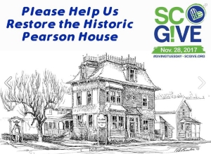
Line art by Peter Beaulieu capturing the historical details of the house in in the 1990s.

On Tuesday Nov 28 the Stanwood Camano community is participating in a collective day of giving.  One of the recipients is the Stanwood Area Historical Society.  We are asking for funds to supplement our budget for repairs and rehabilitation of the D. O. Pearson House Museum windows and other general maintenance historical repairs.  The repair project plan is described on this link: https://www.scgive.org/sahs_project

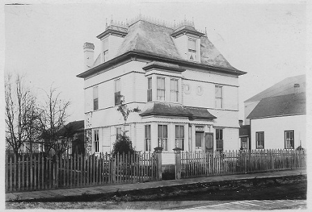
The photo below depicts the Pearson in the 1920s or 30s, sometime before the wooden sidewalks were replaced by concrete.  The photographer of the day is unknown

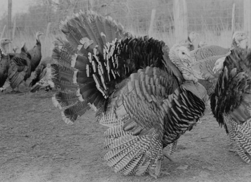
Turkey Farm

Happy Thanksgiving !

Sixty years ago, the Williams Turkey Farm was among the few agricultural businesses on the Island. It is remembered by many local residents, please send us your stories of this or any local Camano Island or Stanwood business!
Thanks!

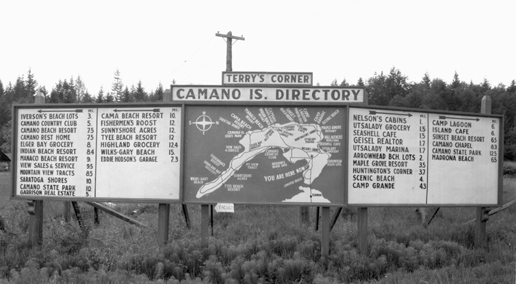
Historical Sign at Terry’s Corner Gateway

Terry's Corner Camano Island Directory

Photographer: Charles Terry. Click the image to see a larger version.

Paul Dorpat, Seattle historical photograph expert shared this photograph with the Stanwood Area Historical Society many years ago. He is a collector of vintage photographs of places in Washington State.

The Camano Island Chamber of Commerce recently updated its Camano Gateway sign at the fork in the road (State Route 532). But this directory shows several now historical places, businesses, resorts, beaches, etc. Note the prominent landmark location referring to Terry’s Corner. This corner used to refer to the intersection of North Camano Drive and Sunrise Blvd which is why there are so many trees in the distance on the hillside behind the sign. There was a stop sign there as there is now. The right turn takes you to Utsalady and the left turn takes you south. This photograph was taken before the fork was put in the State Highway Dept in the 1960s so the photograph would be dated some time in the 1950s or early 60s.  It was located at the time at the stop sign intersection beyond the current gateway Camano Island Chamber of Commerce building because S. R. 532 to the south end had not yet bypassed that intersection.
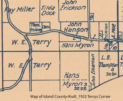
Terrys Corner Kroll Plat Map 1932The name of the photographer has been identified as Charles Terry, the owner of the property at the time.   The 1932 Kroll map clipping shows that at the time it belonged to William Terry, Charles father.  For more on this history, see the book Camano Island Images of America (Arcadia Publishing, 2006.

If you have information that would further date this photograph, such as the dates that Seashell Café existed, please let us know! Contact us.