
 Below are links to the Library of Congress images of Insurance maps of Stanwood and East Stanwood from their Sanborn Fire Insurance Map Collection. Scroll down for direct links.
These links take you away from the SAHS web page. No such maps exist for Camano Island or rural areas of Snohomish County. However there are other maps,plat books and atlases for similar information for those areas. A few are owned by SAHS.
Sanborn Fire Insurance Map from Stanwood, Snohomish County, Washington.
Dec 1905. 2.[images]
Date: 1905-12 (December?)
______________________________
Sanborn Fire Insurance Map from Stanwood, Snohomish County, Washington.
Jan 1909. 2. [Images];
Date: 1909-01 (January ?)
______________________________
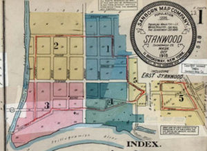
Sanborn Fire Insurance Map from Stanwood, Snohomish County, Washington.
Oct 1918. 6. [images]
Date: 1918-10 (October?)
Sanborn Fire Insurance Map from Stanwood, Snohomish County, Washington.
Oct 1918 – Feb 1953. 6. [images] East Stanwood. 513. [?] Date: 1953-10 (October)
“N” 1941 ? New Report
Rev. no. 3 4/41 (April 1941)
Rev. no. 4 2-53 (Feb.1953)